______________________________________________________________________________
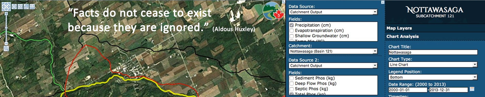
 After fall-out from Canadian drinking water tragedies, including the Town of Walkerton, GREENLAND® focused its software development resources on source water protection. This included the development of an integrated water budget, nutrient and contaminant loading model. This open source GIS-based program included an intuitive and stable interface whereby users were able to quickly create models from scratch. We incorporated features such as customized output files, cross scenario plotting, importing routines and search tools. In 2004, this initiative produced CANWETTM (v1.0), and known also as the "CANadian Watershed Evaluation Tool". We further adapted the software code in 2005-06 for TMDL (Total Maximum Daily Load), assimilative capacity and watershed protection projects and as part of the Version 2.0 development program for the Province of Ontario. CANWETTM (Version 3.0) was completed in 2008. Versions 4.0 through 4.2 until 2012.
In 2013, GREENLAND® and a team affiliated with the University of Waterloo, initiated an information and communication technology development joint venture (and still active today). The goal of that alliance was to utilize Canada-wide open government data resources; Big Data; web-based and mobile application tools; citizen crowd sourcing; social media marketing and other emerging technologies to engage and empower government market places to be more open, efficient and effective. In 2015, the first collaborative technology was completed – namely, the first “Big Data” version of CANWET™ and called ‘CANWET-5”. The platform was then used for P3 collaborative cumulative effects and river basin projects in Canada.
In 2018, the CANWET™ team was expanded to include the University of Guelph. Completed work to-date has included a ‘machine learning prototype’, as well as maintaining all capabilities and adding new / best-science predictive modelling functions too. Further announcements about new project applications will be made and as this partnership extends well beyond 2023.
______________________________________________________________________________
 In 2016, GREENLAND® formed a strategic alliance in Europe with private and public sector teams from Sweden and France and to initiate a new IoT Platform partnership. The initial goal was to develop a cloud-based flood forecasting, flood control and floodplain mapping system (called ISWMS™ - Version ‘2’) for watershed managers and regulatory agencies. The first collaboration was completed in 2019 and where the new web-based tool is being used now in Canada to identify real-time solutions that can minimize mixed rural & urban watershed flood damages and help prevent loss of life from flood disasters. This platform was developed for use anywhere else in the world. It included an early warning flood forecasting system that required powerful visualization connected to the latest (public domain) versions of HEC-HMS and HEC-RAS that are developed /maintained by the U.S. Army Corps of Engineers.
Development of the ISWMS™ Platform relied on other proprietary GREENLAND® hydrology and stormwater management modelling tools. The GREENLAND® (Canada-Europe) team consulted also with property-casualty insurers in order to develop an open/transparent system framework that could also address climate impact concerns. Other Canada-based partners included the County of Simcoe (Ontario); University of Guelph; Communitech Corporation; First Nations; and, University of Waterloo Interdisciplinary Centre on Climate Change (IC3) and Partners for Action (P4A) network. Finally, the U.S. software engineering firm ‘Civil-GEO’ was consulted on the project too. In late 2019, the GREENLAND® team (and also with the University of Guelph) secured leverage funding to continue the ISWMS™ IoT Platform development program. GREENLAND® continues to use ISWMS™ (v.2) as a “free licensed asset” for its consulting client contracts (private and public sectors), and for new collaborations supported by Canada’s National Flood Damage Reduction Program, as well as future Smart Cities & Climate Change Adaptation - Protection Programs.
______________________________________________________________________________
 Cumulative effects assessment is now recognized by all levels of government in Canada and Indigenous People. This policy approach considers past, present and future development stresses together and seeks to maintain impacts below agreed upon thresholds determined from historical or reference watershed conditions. This assessment methodology can effectively identify climate change issues of concern too.
The THREATS™ technology (owned and maintained by GREENLAND®) is a second-to-none web-based platform that is helping Canada’s resource industries to improve cumulative effects assessment procedures for capital project planning and design operations. The tool enables better defining relationships between stressors and environmental responses through more efficient data management, modeling, analyses and visualization.
Capital infrastructure project planning processes by resource companies anywhere in the world use cumbersome manual methods of assessing cumulative environmental impacts posed by a project in concert with impacts from prior and future development over an appropriate scale. The latest version of THREATS™ can provide better understandings of stressor – environmental response relationships by assessing cumulative impacts against reference states and measured responses using appropriate indicators and evaluating trends in multiple datasets over time.
The tool can now help resource industries, land developers and government agencies develop approaches to quantify impacts and risks on a secured platform and to inform better decision making by staffs. Better decisions in the planning phase will also reduce costs and potential for conflict during project consultations, environmental assessments, approvals & implementation phases. For example, mining sites designed using THREATS™ (and to minimize cumulative watershed impacts) will reduce the cost of mitigation measures during operating phases, if failures should occur. Use of the tool will also allow mining companies to examine means of achieving greater efficiencies in the management and reporting of performance monitoring operations, while also reducing life cycle operations and asset management costs.
There are potentially millions of dollars of cost savings by automating and improving the way the resource companies can predict cumulative environmental impacts (air, terrestrial and water) and risks associated with any extraction activities. The benefits of the latest THREATS™ web-based decision support system include the following benefits from these perspectives:

Provincial Parliament - Riding of Barrie-Innisfil
As the Member of Provincial Parliament for the riding of Barrie-Innisfil, I am pleased to extend my congratulations to The Greenland Group of Companies on the occasion of their 25th Anniversary.
Thank you for growing your business with a focus on making a minimal impact on the environment. The experience that you have gained already will prove invaluable to smarter, innovative developments.
I wish you continued success in delivering award-winning engineering and technologies as you serve communities across Canada.
Sincerely,
Andrea Khanjin
Barrie-Innisfil MPP
Interdisciplinary Centre on Climate Change
We are pleased to write in full support of the Canada-Europe Partnership, particularly the collaboration of the Interdisciplinary Centre on Climate Change (IC3) and the
Partners for Action (P4A) network to support incorporation of climate change considerations in the project and assist in testing FLOODVIEW with Canadian municipalities and insurers.
P4A and IC3 are dedicated to consideration of climate change in Canada’s approach to flood risk management, and dissemination of knowledge and best practices to the insurance industry, government decision-makers, and the Canadian public. We look forward to partnering with you to identify effective solutions to minimize urban flooding.
Dr. Daniel Scott
Executive Director
Interdisciplinary Centre on Climate Change
Faculty of Environment University of Waterloo
October 20, 2015
Six Nations Council
On behalf of the Environment Office of the Six Nations of the Grand River, we would like to thank Greenland International Consulting Limited for the work completed to prepare the Master Drainage and Flood Remediation Plan (MDFRP) for the McKenzie Creek watershed. This plan has now enabled our office to identify the flood prone residences throughout the watershed with the flood plain mapping that has been prepared as part of this assignement. We appreciate the role that Greenland has played in assisting our office in directing Public Works with prioritizing the remedial projects to be completed in the flood prone areas.
We also appreciate Greenland's effort in assisting the Six Nations of the Grand River with the preparation of funding applications to secure the resources to complete these remedial works. We are convinced that this MDFRP can be used as a template for completing similar drainage and flood remediation works both locally and in other First Nations lands.
We look forward to working with your company again in the near future on the remaining watersheds that need this important work done.
Thank you for your ongoing assistance.
Clynt King
Environmental Technician
Six Nations Council Environment Office
July 25, 2016